Planning a safe and enjoyable boating journey begins long before casting off the dock. The initial preparation is what separates a smooth day on the water from one filled with uncertainty and unnecessary risk. For new and experienced skippers alike, mapping a boat trip is not just about drawing lines on a chart—it’s about anticipating weather, understanding tides, planning fuel stops, and building in alternatives if conditions change. In Australia, where waterways range from calm estuaries to complex coastal passages and reef-filled waters, taking the right first steps ensures confidence and safety. By approaching navigation systematically, you can turn planning into a process that adds both security and enjoyment to your time on the water.
Step 1: Define Your Route and Destination
The first step in mapping your boat trip is setting clear goals for the journey. Ask yourself:
- Where is your intended destination?
- Will this be a short day trip, a weekend cruise, or a longer passage?
- Are there specific anchorages, fishing spots, or marinas you want to include?
When boating in Australia, destinations might range from Sydney Harbour’s busy channels to the Whitsundays’ island anchorages or the intricate inlets of Western Australia. Understanding your primary route allows you to assess the distance, time required, and potential fuel consumption before you leave shore.
See also: How Technology Is Revolutionizing Traditional Education
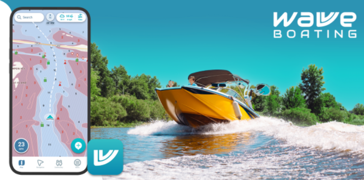
Step 2: Gather Updated Charts and Resources
Accurate charts are non-negotiable. Choose reliable electronic navigation tools or paper charts and make sure they are current. Many waterways shift due to sedimentation, dredging, or new navigational markers. Using outdated information could mean running aground or missing safe channels.
Electronic charts, paired with GPS, provide a dynamic view of your position. However, paper charts remain an important backup, particularly if electronics fail. For Australian waters, ensure your resources include tidal information, marine park zoning maps, and local notices to mariners.
Step 3: Check Weather and Tides
No plan is complete without a thorough review of weather and tidal data. Conditions on the water can change rapidly. High winds, storms, and tide shifts can all alter your journey significantly.
- Weather: Use marine forecasts that cover wind speed, direction, wave height, and storm warnings.
- Tides: In coastal regions, tidal shifts determine when shallow bars or estuary entrances are safe to cross.
- Currents: In areas like northern Australia, strong currents can drastically affect travel time and fuel efficiency.
Planning your departure and return around favorable conditions minimizes risks and makes for a smoother ride.
Step 4: Identify Hazards and Waypoints
Mapping a boat trip means more than drawing a straight line from A to B. Consider hazards along the way—reefs, rocks, shipping lanes, or areas with heavy recreational traffic. Setting waypoints around these areas allows for safer navigation and builds flexibility into your route.
In regions like the Great Barrier Reef, waypoint planning is especially critical. Routes need to avoid coral heads and account for marked channels. By identifying key navigational points, you reduce the stress of decision-making while underway.
Step 5: Plan Fuel and Supply Stops
Running out of fuel is one of the most common boating mishaps. A solid plan includes:
- Calculating total fuel needed, including a 20–30% reserve.
- Checking where refueling stations are located.
- Factoring in supplies like food, water, and safety equipment.
Longer routes, such as coastal passages between marinas in New South Wales or Queensland, demand a more detailed supply strategy.
Step 6: Create a Float Plan
Safety experts recommend filing a float plan with a trusted contact. This document outlines your intended route, departure and return times, boat description, and passenger details. If you don’t return as expected, authorities have the information they need to locate you quickly.
In Australia, filing float plans is particularly valuable when heading into remote waters where mobile coverage is limited. Combining this with a VHF radio or an EPIRB (Emergency Position Indicating Radio Beacon) adds another layer of safety.
Step 7: Prepare for Contingencies
No matter how well you plan, conditions can change. Always prepare alternative routes and safe harbors in case of mechanical problems or bad weather.
For example, if you’re cruising from Cairns to the Whitsundays, know which marinas or anchorages you can divert to if winds pick up or equipment fails. Building this redundancy into your plan gives you peace of mind and ensures you’re never without options.
Step 8: Double-Check Gear and Crew Readiness
Before leaving, confirm that both equipment and passengers are ready:
- Safety gear: lifejackets, flares, fire extinguishers, and radios must be inspected and functional.
- Navigation tools: ensure GPS, chartplotters, and apps are updated.
- Crew: brief passengers on safety basics and assign responsibilities if needed.
Taking time at the dock to double-check saves time and stress later.
Complementary Gear for Safer Trips
Beyond charts and GPS, quality gear enhances preparedness. Investing in waterproof storage, reliable communications, and safety equipment is just as important as plotting your course. For example, rugged Garmin handheld GPS units make excellent backups to onboard systems, offering resilience if your primary navigation electronics fail.
Conclusion
The first steps in mapping a boat trip involve more than simply deciding where to go. They encompass setting clear routes, checking charts, reviewing weather and tides, marking hazards, planning fuel stops, filing a float plan, and preparing for contingencies. For boaters in Australia, where conditions can shift rapidly and distances between safe harbors may be significant, thorough preparation ensures safety, confidence, and peace of mind. When done well, mapping isn’t just a safety task—it’s the foundation for an enjoyable and memorable boating experience.